Google Adds Geographic Terrain Imagery To Maps
Google continues to improve upon its Google Maps; earlier this week it announced that Googlers were mapping the Grand Canyon with backpack-mounted cameras, and now the company has added layers to its maps that show the terrain, color gradation indicating vegetation, and additional labels that show natural land formations.
This is all an effort to show locations with more intelligence and context. For example, if you can see where a mountain range is located, the location and layout of surrounding big cities and rural countryside make more sense.
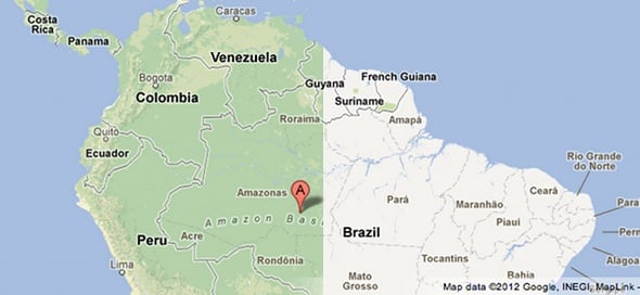
L: The new terrain and vegetation overlay; R: the old look of Google Maps
Further, it’s somewhat marvelous to be able to see important geological areas labelled. The example Google gave in a blog post is of the Amazon Basin. When you can see the thick vegetation, wide area, and helpful label on that area of South America, you can appreciate the magnitude of that place.
The concept of maps is a powerful one, and never before have people had such convenient and powerful access to maps with this breadth and depth. A curious mind could get lost for hours poking around different parts of the globe with Google Maps.
This is all an effort to show locations with more intelligence and context. For example, if you can see where a mountain range is located, the location and layout of surrounding big cities and rural countryside make more sense.
L: The new terrain and vegetation overlay; R: the old look of Google Maps
The concept of maps is a powerful one, and never before have people had such convenient and powerful access to maps with this breadth and depth. A curious mind could get lost for hours poking around different parts of the globe with Google Maps.