Google Maps Adds Real-Time Bikeshare Information For These Cities
How people get around in big cities has changed dramatically in recent years, and for those who don't live in big cities, it can be hard to figure out where to get and return these new modes of transport (a la bikesharing). Google Maps is looking to make it easier for people trying to get around in urban areas to find bikesharing pickup and drop off locations. Google says that estimates show there are more than 1,600 bikesharing systems and over 18 million shared bikes in urban centers globally.
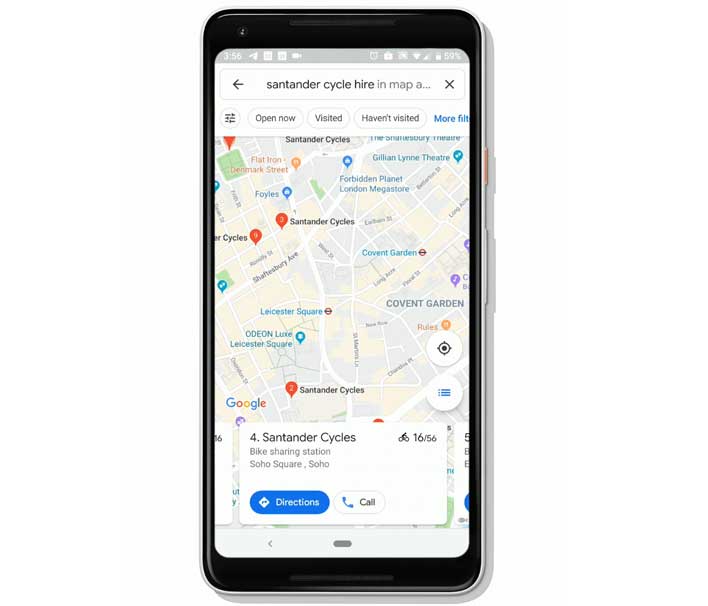
Google notes that for the last year, travelers and commuters in New York City have been using Google Maps to locate bikesharing stations and to see how many bikes are available at a station in real-time. Google rolled out the feature with a total of 24 cities in 16 countries this week. The cities where the bikesharing details are available include:
- Barcelona
- Berlin
- Brussels
- Budapest
- Chicago
- Dublin
- Hamburg
- Helsinki
- Kaohsiung
- London
- Los Angeles
- Lyon
- Madrid
- Mexico City
- Montreal
- New Taipei City
- New York City
- Rio de Janeiro
- San Francisco Bay Area
- São Paulo
- Toronto
- Vienna
- Warsaw
- Zurich
In those cities, Google Maps can be used to locate bikesharing stations and know exactly how many bikes are available near you. The app can also tell users if there are empty spots available at a station near your destination to drop the bike off. The new feature is possible thanks to a partnership with Ito World that feeds global bikesharing data directly into Google Maps. Bikesharing data is available in the cities listed above on Android and iOS apps with more cities being added later. Last month Google Maps added on-screen speedometer and an enhanced SOS feature for natural disasters.