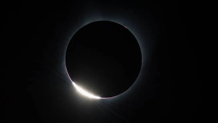
NASA Details Solar Eclipse Path Of Totality For Amazing Views In The US
When star gazers look up to the night sky, the Moon appears to be a nicely shaped round orb. However, the Moon is actually not quite round, and neither is Earth. According to NASA, the Moon is a “rugged world of peaks, basins, and valleys.” Having the knowledge of the precise shape of the Moon and its position relative to the sun, NASA can understand exactly where its shadow will darken Earth’s surface.
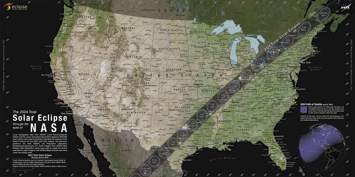
NASA says that today’s eclipse maps account for not only the lunar landscape, but also for the contours of Earth’s mountain ranges, lowlands, and other features. For a very long time, eclipse maps depicted the shape of the Moon’s umbra on the ground as a smooth ellipse. However, the shape is greatly altered by both the rugged lunar terrain, and the elevations of observers on the Earth.
The math that is currently used to predict and map eclipses was devised by Friedrich Wilhelm Bessel in 1829. It was later “expressed in its modern form” by William Chauvenet in 1863. Bessel’s method utilizes a coordinate system based on a plane, called the fundamental plane, which passes through the center of the Earth and perpendicular to the Sun-Moon line. NASA remarked that this “greatly simplifies the calculations.” The intersection of the Moon’s shadow with the plane is said to always be a circle.
By using this coordinate system, it is possible for agencies such as NASA to calculate just a handful of numbers, called Besselian numbers. These numbers are then “plugged” into various equations to predict almost anything anyone wants to know about an eclipse. This system allows NASA and others to not only predict eclipses occurring in the present, but also allows them to compare hundreds, or even thousands, of eclipses from the past and in the future.
Of course, in modern times, there is a lot more data to work with as well. The map that NASA is using for the 2024 total solar eclipse uses datasets from several NASA missions. The eclipse data was calculated by visualizer Ernie Wright using elevation information from the Shuttle Radar Topography Mission (SRTM), lunar topography from the Lunar Reconnaissance Orbiter (LRO), and planetary positions from the JPL DE241 ephermeris. Lead Visualizer, Michael Garrison, also used imagery of the Earth from NASA’s Blue Marble Next Generation to create the terrain map.
Even with all this data and equipment, predicting the precise path of totality can be tricky. This can be seen in the fact that in the weeks and days leading up to the 2024 total solar eclipse, the path of totality has been adjusted slightly. Anyone who wants a front row seat to the total eclipse and cannot make it to the path of totality can still take part in the event through a NASA livestream, which can be watched via the second YouTube video above.