NASA Shares A Sweet High-Res Map Of US Solar Eclipse Times And Locations Through 2024
For anyone who wants the best view possible of a solar eclipse, knowing where and when to be is vital. NASA's new solar eclipse map is an excellent tool for providing those important details through 2024. The map highlights the annular eclipse and total eclipse in dark bands, as seen in the image below.

"In 2017, I was in Maryland, so I still got to see a little bit, because I was in a partial eclipse," Garrison remarked. "But I didn't really know any of this back then. This does make me want to go to, say, Albuquerque in 2023. And then in 2024 to go more south."
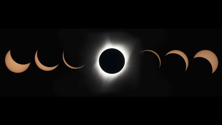
The dark paths indicate where observers will want to be in order to view the "ring of fire," which is when the Moon blocks all but the outer edge of the Sun during an annular eclipse, and the white outer atmosphere of the Sun when the Moon completely blocks the Sun's disk during a total eclipse. If you happen to be outside of those dark paths, the map also shows how much the Sun will be partially blocked by our lunar space rock.
For those who are located in the dark bands, running from Oregon, there will be a chance to see the annular eclipse if weather permits. Those in the band that runs from Texas to Maine will have a chance to view the total eclipse, if the skies are clear. There is a zoom feature that allows for easier viewing of the map.
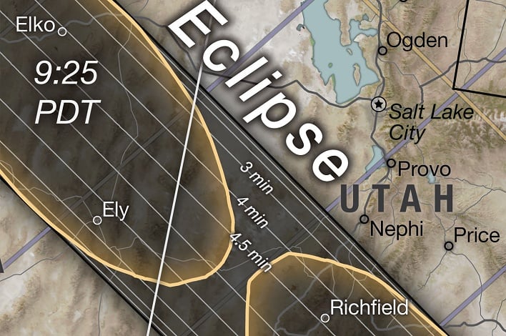

While the map only shows the viewing area for the contiguous U.S., those in Canada, Mexico, Central America, and South America will also be able to view at least a partial eclipse. There is a global map with full paths of the 2023 annular eclipse available as well.